UK Adventures

Top 5 Hikes Near Bristol Reachable by Bus or Train

30th July

5 Min Read

Share this post

You probably already know that Bristol is fantastic for culture, nightlife and its food scene. An added bonus is that whether you live in Bristol or are just visiting, you don’t have to venture far out of the city to find some great hiking spots. If you’re after a pretty countryside amble, a trek through some spectacular landscape or an invigorating coastline walk, Bristol has it all within an hour’s drive.

Here’s our round-up of our top five walks near Bristol, covering north, south, east and west of the city. Each one offers something different and you can reach all of them by either bus or train. Plus, most of them are dog friendly and include great pub, restaurant or café options for a post-hike lunch or a pick-me-up drink along the way.

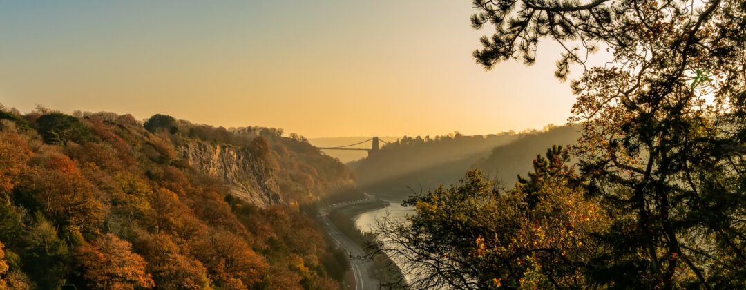
Sunrise view over a wooded river valley and distant suspension bridge, ideal for hiking near Bristol by train or bus

Cheddar Gorge Viewpoint Loop (south of Bristol)

Distance: 4.7 miles / 7.6 km

Approx. hiking time: 2 hours 15 minutes

Travel time from central Bristol: 40 minutes by car; two hours by bus (number 376 Mendip Explorer Bristol-Wells, number 126 Wells-Church Street, Cheddar)

Dog friendly? Yes, but it’s advisable to keep dogs on a lead at the viewpoint due to sudden drops around the cliff edges.

Route: Cheddar Gorge viewpoint loop from Cheddar

Located in the Mendip Hills, Cheddar Gorge is the largest of its kind in England at over 120 metres deep and nearly five kilometres long. Starting out from the tiny village of Cheddar (yes, home of the cheese!), you’ll first encounter the incredible landscape on your approach, as the road that runs through the village is nestled between the huge cliff faces of the limestone gorge.

There’s a variety of walks you can do around the gorge and surrounding area but the Cheddar Gorge Viewpoint hike is definitely the most impressive. The ascent to the summit has got some striking sights along the way too – look out for a great view of Lion Rock and the ancient Bake Hole cave towards the beginning of the walk.

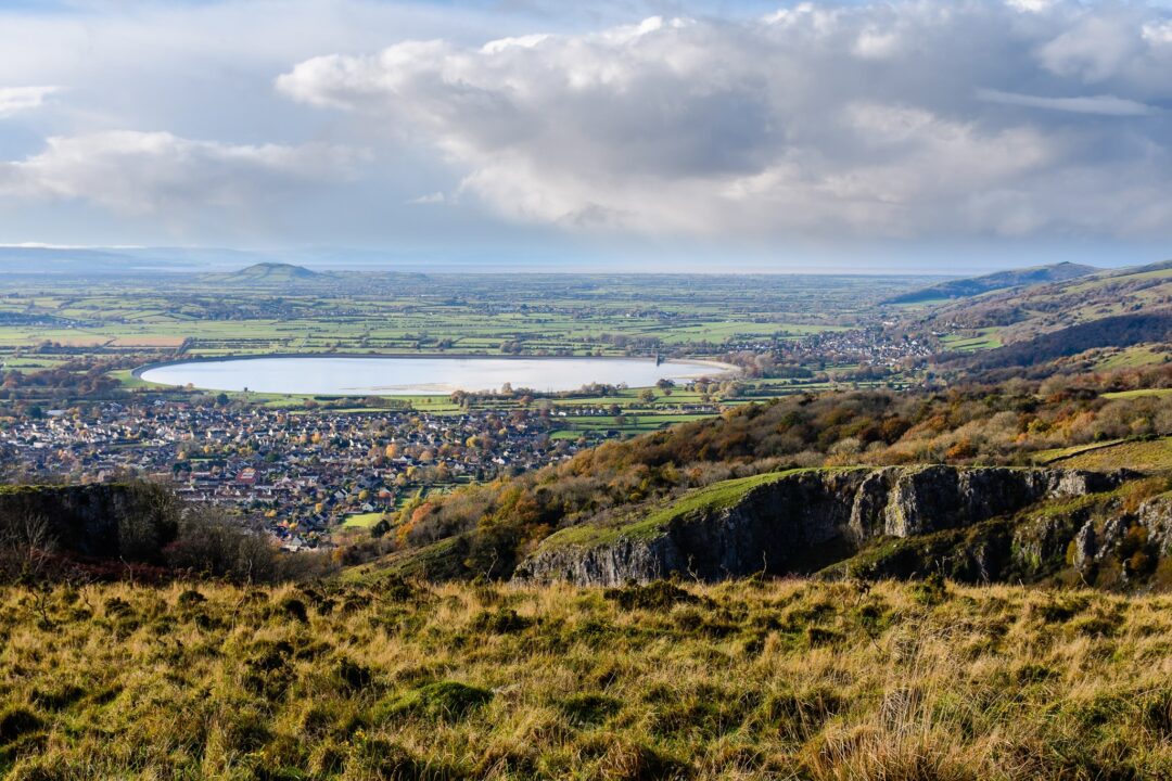
The route through the woodland is a steep and rocky, but you’ll be rewarded with the fantastic scenes to be found when you reach the top. From the top of the gorge you can see for miles across the green Mendip Hills, including the Cheddar Reservoir, a perfect view for a picnic (weather dependent!). It’s also a great place to admire the remarkable and unusual terrain as you look out across the gorge. For an even better view you can also climb to the top of the Cheddar Gorge Lookout Tower, descend back to the starting point via the 274-step Jacob’s Ladder staircase.

Cheddar has a number of options for food and drink. The White Hart is an especially dog-friendly pub so it gets out recommendation.

View over rolling hills, river valley and townscape, suitable for hikes near Bristol reachable by train

Bath Skyline (east of Bristol)

Distance: 6 miles / 9.6 km

Approx. hiking time: 3 hours

Travel time from central Bristol: 50 minutes by car; 45 minutes by train (walk to Bristol Temple Meads station, 11 minute train ride to Bath Spa station, walk to Bathwick Hill at Cleveland Walk)

Dog friendly? Yes, but there are sometimes sheep and cattle on this route so keep your dog on the lead or under close control in areas where farm animals are present.

Route: Bath Skyline walk

Only a short train hop from Bristol, Bath is a pretty Georgian city which attracts millions of visitors every year. It’s also surrounded by some fairly steep hills. For a totally different perspective though, we recommend getting away from the crowds and seeing Bath from above with the Bath Skyline walk.

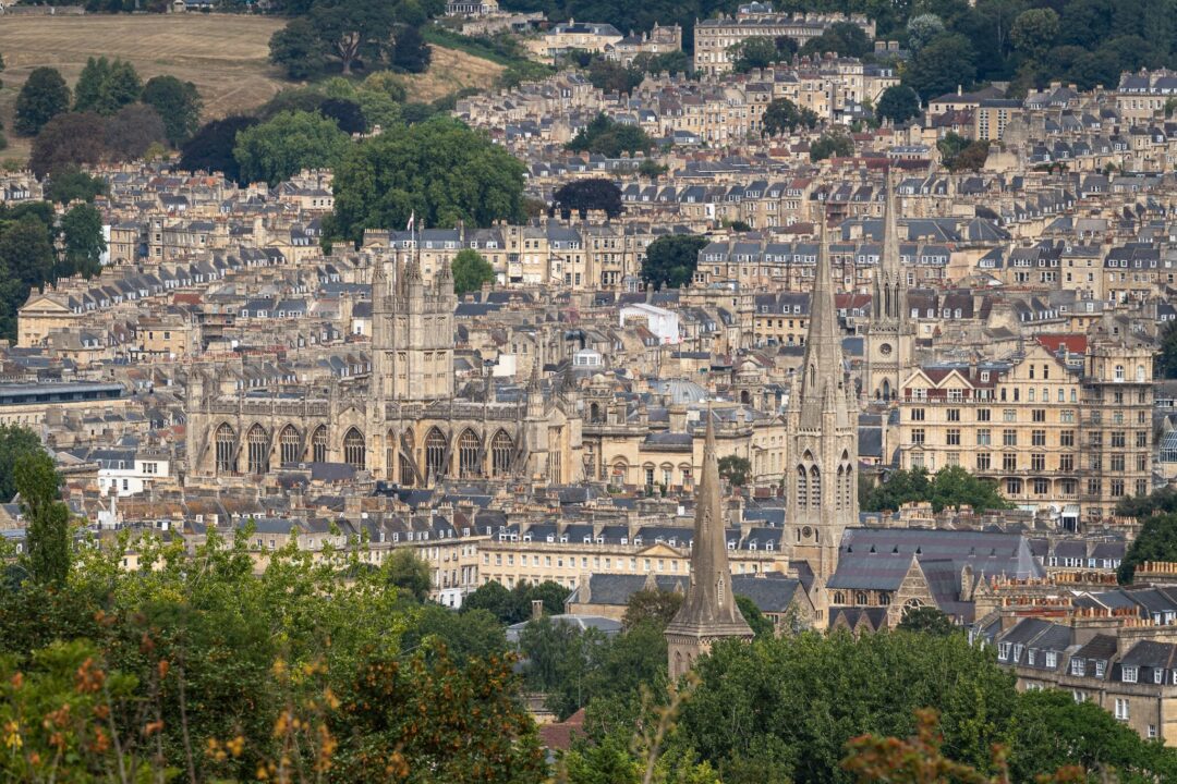
This route offers panoramic views of the city from the surrounding countryside, where you can appreciate both the picturesque architecture of Bath and the rolling, tree-lined hills that encompass it.

One of the first sights on this circular route is Sham Castle, a turreted Grade II listed building which dates back to the late 1700s. The walk then takes you through woodland, across the remnants of an old tramway and over peaceful wildflower meadows.

Arguably the best view of Bath can be seen in the second half of the walk, at the foot of Lyncombe Vale, where the honey-coloured city buildings are visible between the hills.

The route then rounds off by taking you through the tranquil Smallcombe Garden Cemetery and ancient woods, before reaching the starting point back at Bathwick Hill.

The start and end point is a 20 minute walk from the city centre and there are lots of pubs, cafes and restaurants to choose from in central Bath for a post-hike meal or drink.

Bath Abbey and historic rooftops in Bath, Somerset, UK, viewed from above

Dundry Hill Circular (south of Bristol)

Distance: 2 miles / 3.2 km

Approx. hiking time: 1 hour

Travel time from central Bristol: 25 minutes by car; 30 minutes by bus (672 Bristol-Church Road, Dundry)

Dog friendly? Yes, this is a popular walk for dog-walkers, but as you’ll be crossing farmland there may be sheep or cows around so you should keep your dog on a lead in these areas. It’s also worth noting that there are a few stiles on this walk which you may need to lift your dog over.

Route: Dundry Hill Circular

If you’re after a short hike with great views that’s not far out of the city, Dundry Hill is perfect. There’s a great dog-friendly pub in the village to start or end your hike with too: Dundry Inn, known for its Sunday Roasts (including good vegan options)!

This circular walk across the small village of Dundry’s hilltop has beautiful scenery in every direction, with 360-degree views across Bristol, the Bristol Channel, the Mendip Hills, the Somerset Hills and even out to South Wales. The loop takes you through lush green fields, down a lovely country lane sheltered in greenery and across a quiet country road. You’ll also walk through Dundry village and past its impressively tall church, just a stone’s throw from the Dundry Inn pub.

The walk starts out with views to the north and west, with Bristol laid out below and the Bristol Channel and South Wales visible beyond (you can also try to spot the Severn Bridge!). As you continue the loop to the west, you’ll come across stunning views of the Somerset Hills and the blue hues of Barrow Gurney Reservoirs at the foot of them.

Facing southward, you can see the Chew Valley, Chew Valley Lake and the rises of the Mendip Hills, a gorgeous patchwork view of the English countryside. After walking a little further, the loop ends with a wander back through the pretty village (and, if you like, to the pub!)

Portishead to Clevedon Coastal Path

Distance: 5.6 miles / 9 km

Approx. hiking time: 2 hours 30 minutes

Travel time from central Bristol: 40 minutes by car, after the hike take the X5 bus Clevedon-Portishead to return to your car; 1 hour by bus from Bristol (X4 Bristol-Portishead); return bus 50 minutes (X6 Clevedon-Bristol)

Dog friendly? Yes, dogs are welcome on the coastal path, but keep an eye out for steep cliff edges along the way.

Route: Portishead to Clevedon Coastal Path

Blow the cobwebs away on this coastal hike that runs between the nearby seaside towns of Portishead and Clevedon, taking in spectacular views of the Bristol Channel and a lungful of fresh sea air.

You can begin the hike from any point in Portishead (you’ll just need to make your way down to Mariner’s Path on the coast), but we think the town’s pretty Lake Grounds is a good starting point, not only because you can grab a coffee or sandwich from the Lakeside Café before you set out. From here walk down Portishead’s Esplanade, the town’s seafront, before joining Mariner’s Path. If you’d prefer a sit-down meal before the hike, the Windmill Inn at the start of the coastal path is a great pub with fantastic views across the Severn Estuary to south Wales.

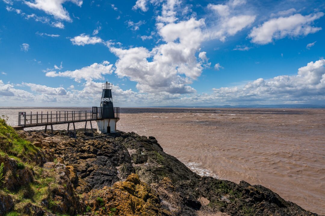
Roughly a mile into the hike, look out for Black Nore Lighthouse, a Grade II listed building that dates back to the late 19th century, when it used to navigate passing ships. This striking white structure sits at a brilliant viewpoint across the Channel, and there are several benches around the lighthouse if you want to stop and take in the views a little while longer.

Continue to follow the coastal path south and you can’t really go wrong on this route. You’ll pass several shingly beaches, including Redcliff Bay, Walton Bay, Margaret’s Bay and Ladye Bay, each one a chance for spectacular sights (and photos) of the Bristol Channel and the coastal cities and towns of south Wales across the water.

From Ladye Bay, you’ll be able to see the silhouette of Clevedon Pier, the hike’s finish point. Said to be the most beautiful pier in England, we suggest you buy yourself a stick of rock from the pier shop before strolling to the end and admiring the panoramic views out to sea. The Pier’s Glass Box restaurant offers tasty fish and chips (plus vegan options) if you’d like a meal before hopping back on the bus to Portishead or Bristol, depending on your mode of transport. Of course, you can always double the distance and hike your way back the way you came if you fancy a longer day!

Coastal viewpoint on rocky shoreline with sea and lighthouse, under blue sky and clouds near Bristol

Alveston Alpacas Loop from Thornbury (north of Bristol)

Distance: 5.6 miles / 9 km

Approx. hiking time: 2 hours 30 minutes

Travel time from central Bristol: 35 minutes by car; 55 minutes by bus (T1 Bristol-Rock Street, Thornbury)

Dog friendly? It depends. Although there is fencing between the path and the alpaca fields, if your dog is likely to react around the animals it’s probably best to leave them at home for this one. It’s also worth noting that there may be sheep or cows in the fields, and there are a number of stiles on the route that you might have to help your canine pal over.

Route: Alveston Alpaca Loop

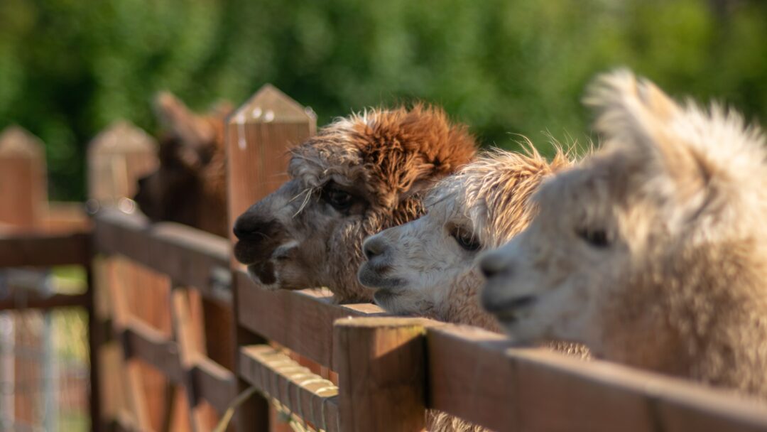
Looking for something a little different? This route goes straight through an alpaca farm and their fields, meaning you can get up close to admire these unusual, fluffy creatures. If that wasn’t enough to convince you, this walk features mostly wide, open fields, lots of twisty country lanes and quaint farmhouses. It also begins and ends in the market town of Thornbury, about 16 km north of Bristol.

This circular hike covers both town and countryside, and is a good opportunity to admire bustling Thornbury and its historic Tudor castle and 12th century church. Thornbury also has lots of cafes, restaurants and pubs to choose from plus an array of quirky independent shops that you can check out either before you set off or as a way to round off your trip afterwards.

After leaving Thornbury, the walk takes you through the countryside that lies between the town and the village of Alveston, a former royal manor and now home to the Wolfridge alpacas! This route gives you an excellent view of these woolly animals and follows a track between their fields.

Once you’ve had your fill of alpaca watching, the hike loops out to the east and north across sprawls of green fields and farmland, down winding, tree-lined paths and quiet country roads.

The route finishes with a view of Thornbury from above as you head down grassy, sloped pastures, before navigating you back into the town.

Once you’re back, why not  treat yourself to afternoon tea at Thornbury Castle afterwards or check out those quirky shops we mentioned earlier.

Dogs peeking over a wooden fence outdoors with green countryside in the background

Adventure Communities in Bristol

Now you’ve got the hikes, who will you go with?

Check out the following Facebook groups to connect with like-minded women and meet new friends!

Bristol Hiker Girls

This is a meetup group for women living in Bristol and the surrounding areas to get together and go for a walk. It’s a friendly space to meet new friends and get out in nature.

Bristol Hiker Girls

Black Girls Hike

Founded in 2019, Black Girls Hike U.K. provides a space for Black women to explore the outdoors. Challenging the status quo, and encouraging black women to reconnect with nature, the group hosts nationwide group hikes, outdoor activity days and training events.

Black Girls Hike

Love Her Wild Bristol

Love Her Wild Bristol, Somerset & Wiltshire group is a place to find other local women in the Love Her Wild community to plan adventures with.

Love Her Wild Bristol

Adventure Queens Bristol

AQ provides physical and virtual spaces for all women to offer practical information, tips and advice to better equip women for outdoor adventures.

Adventure Queens Bristol

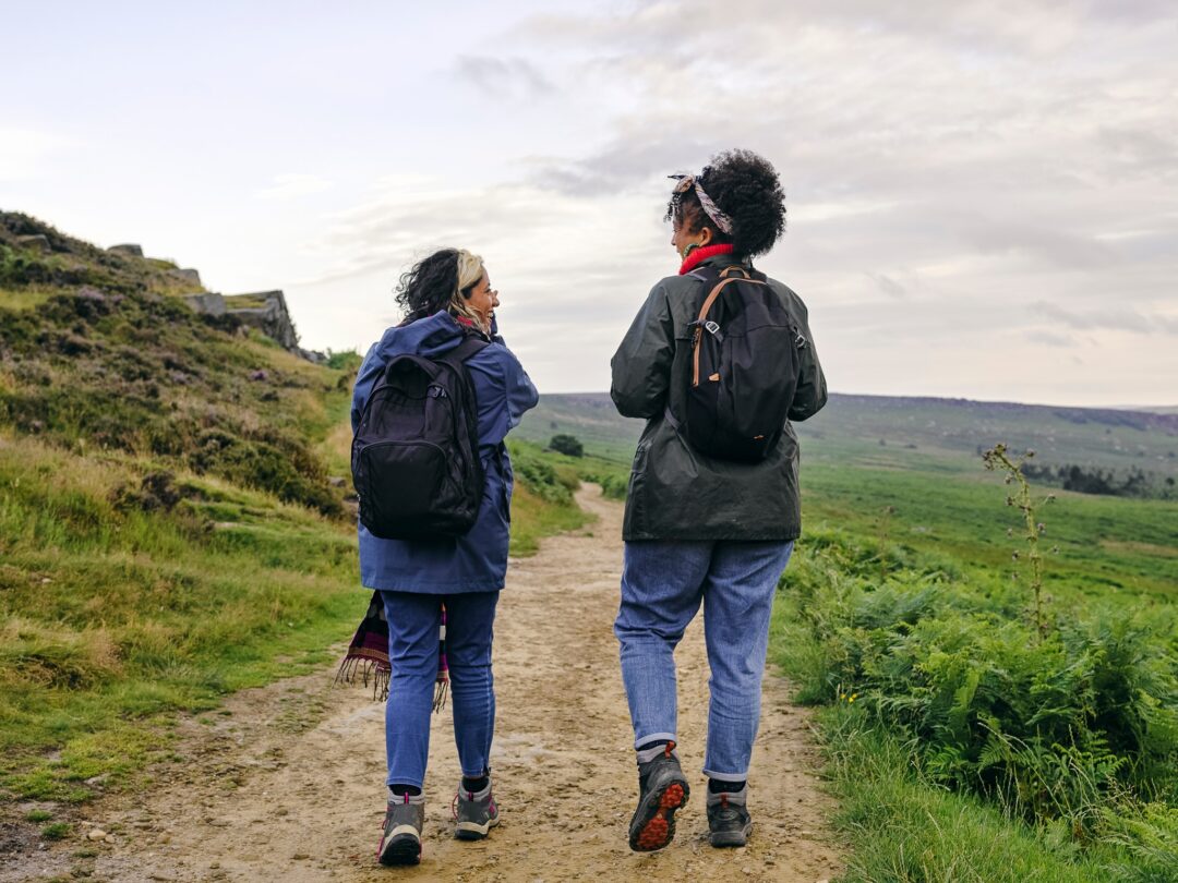
Two women hiking on a rural footpath with backpacks, overlooking grassy hills under a cloudy sky
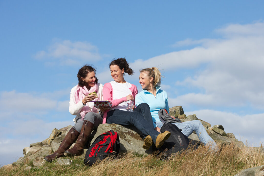
Three women on a rocky hilltop during a hiking break, with backpacks against a blue sky

Bookings Team

We are a small team of women who plan the trips, host them, answer your emails and walk, ski and paddle the routes ourselves. When a post has no single name on it, it usually means several of us had something to add.

UK Adventures

30th July

5 Min Read